Wereport the first δ18Oandδ2H data of Virunga rainfall in the Eastern Democratic Republic of the Congo, situated on the limit between Central and Eastern Africa. The dataset is from 13 rain gauges deployed at Mount Nyiragongo and its surroundings sampled monthly between December 2013 and October 2015. The δ18O and δ2H vary from −6.44 to 6.16‰, and −32.53 to 58.89‰ respectively, and allowed us to define a LMWL of δ2H= 7.60δ18O+16.18. Three main wind directions, i.e. NE, E and SE, were identified in the upper atmosphere corresponding to threemajormoisture source regions. On the contrary, lower atmosphericwinds areweaker in nature and originate mainly from the S and SW, creating a topographically-driven, more local moisture regime. The latter is due to the accumulation in the floor of the rift of water vapor from Lake Kivu forming a layer of isotopically enriched vapor thatmediates the isotope enrichment of the falling raindrops. A strong seasonality is observed in both δ18O and δ2H data, and is primarily driven by combined seasonal and spatial variation in the moisture sources. The δ18O and δ2H seasonality is thus correlated to weather patterns, as the latter control the wet to dry season shifting, and vice versa. The key characteristic of seasonality is the variation of monthly precipitation amounts, since the mean monthly air temperature is nearly constant on an annual scale.

 https://volcanofoundation.org/wp-content/uploads/2021/06/Download-4-1.jpeg
828
1440
Anne Fornier
https://volcanofoundation.org/wp-content/uploads/2021/04/volcano-foundation-1-1.png
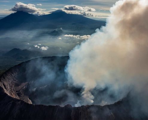
Anne Fornier2021-06-25 09:45:532021-10-05 19:43:24BIOMONITORING SURVEY AT VIRUNGA VOLCANIC PROVINCE
https://volcanofoundation.org/wp-content/uploads/2021/06/Download-4-1.jpeg
828
1440
Anne Fornier
https://volcanofoundation.org/wp-content/uploads/2021/04/volcano-foundation-1-1.png
Anne Fornier2021-06-25 09:45:532021-10-05 19:43:24BIOMONITORING SURVEY AT VIRUNGA VOLCANIC PROVINCE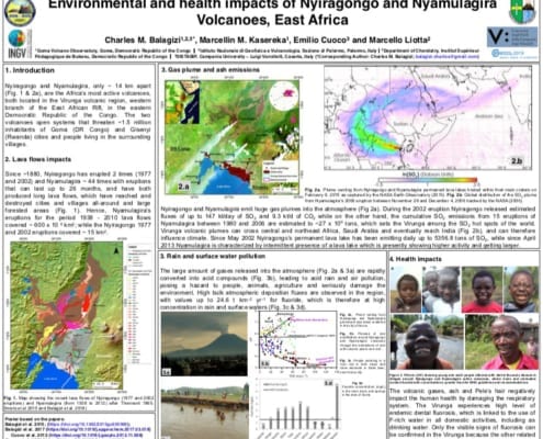 https://volcanofoundation.org/wp-content/uploads/2020/11/charles-balagizi-Environmental-and-health-impacts-of-Nyiragongo-and-Nyamulagira-Volcanoes-East-Africa.jpg
628
746
Anne Fornier
https://volcanofoundation.org/wp-content/uploads/2021/04/volcano-foundation-1-1.png
Anne Fornier2020-11-26 11:50:362021-09-27 17:17:49ENVIRONMENTAL & HEALTH IMPACTS OF NYIRAGONGO & NYAMULAGRIA
https://volcanofoundation.org/wp-content/uploads/2020/11/charles-balagizi-Environmental-and-health-impacts-of-Nyiragongo-and-Nyamulagira-Volcanoes-East-Africa.jpg
628
746
Anne Fornier
https://volcanofoundation.org/wp-content/uploads/2021/04/volcano-foundation-1-1.png
Anne Fornier2020-11-26 11:50:362021-09-27 17:17:49ENVIRONMENTAL & HEALTH IMPACTS OF NYIRAGONGO & NYAMULAGRIA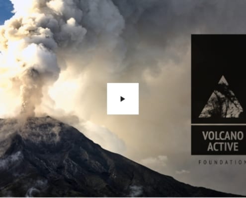 https://volcanofoundation.org/wp-content/uploads/2019/10/crowdfounding-volcano-active-foundation.jpg
754
1246
Anne Fornier
https://volcanofoundation.org/wp-content/uploads/2021/04/volcano-foundation-1-1.png
Anne Fornier2019-11-12 15:08:322021-09-27 17:20:09SERIES OF DOCUMENTARIES TO EDUCATE THE WORLD
https://volcanofoundation.org/wp-content/uploads/2019/10/crowdfounding-volcano-active-foundation.jpg
754
1246
Anne Fornier
https://volcanofoundation.org/wp-content/uploads/2021/04/volcano-foundation-1-1.png
Anne Fornier2019-11-12 15:08:322021-09-27 17:20:09SERIES OF DOCUMENTARIES TO EDUCATE THE WORLD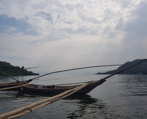 https://volcanofoundation.org/wp-content/uploads/2019/04/20180609_144602-e1568884935340.jpg
1485
1980
Anne Fornier
https://volcanofoundation.org/wp-content/uploads/2021/04/volcano-foundation-1-1.png
Anne Fornier2019-04-09 08:12:012021-09-27 17:30:07DEADLY LAKES
https://volcanofoundation.org/wp-content/uploads/2019/04/20180609_144602-e1568884935340.jpg
1485
1980
Anne Fornier
https://volcanofoundation.org/wp-content/uploads/2021/04/volcano-foundation-1-1.png
Anne Fornier2019-04-09 08:12:012021-09-27 17:30:07DEADLY LAKES https://volcanofoundation.org/wp-content/uploads/2018/12/volcano-foundation-news-05.jpg
1080
1920
Anne Fornier
https://volcanofoundation.org/wp-content/uploads/2021/04/volcano-foundation-1-1.png
Anne Fornier2019-04-03 16:24:092021-09-27 17:31:10NATURAL HAZARDS IN GOMA AND THE SURROUNDING VILLAGES
https://volcanofoundation.org/wp-content/uploads/2018/12/volcano-foundation-news-05.jpg
1080
1920
Anne Fornier
https://volcanofoundation.org/wp-content/uploads/2021/04/volcano-foundation-1-1.png
Anne Fornier2019-04-03 16:24:092021-09-27 17:31:10NATURAL HAZARDS IN GOMA AND THE SURROUNDING VILLAGES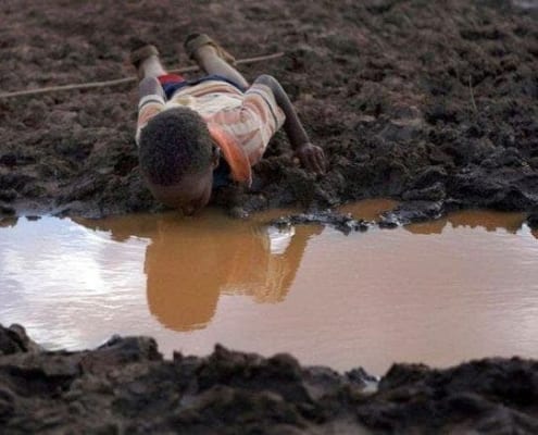 https://volcanofoundation.org/wp-content/uploads/2019/08/contaminacion-agua-volcan-africa.jpg
437
720
Anne Fornier
https://volcanofoundation.org/wp-content/uploads/2021/04/volcano-foundation-1-1.png
Anne Fornier2019-04-03 15:48:212021-09-27 17:31:24INFLUENCE OF MOISTURE SOURCE DYNAMICS AND WEATHER PATTERNS IN CENTRAL-EASTERN AFRICA
https://volcanofoundation.org/wp-content/uploads/2019/08/contaminacion-agua-volcan-africa.jpg
437
720
Anne Fornier
https://volcanofoundation.org/wp-content/uploads/2021/04/volcano-foundation-1-1.png
Anne Fornier2019-04-03 15:48:212021-09-27 17:31:24INFLUENCE OF MOISTURE SOURCE DYNAMICS AND WEATHER PATTERNS IN CENTRAL-EASTERN AFRICA