CREAR CONOCIMIENTO DE LOS RIESGOS
¿POR QUÉ NACIÓ LA FUNDACIÓN? >
¿POR QUÉ NACIÓ LA FUNDACIÓN? >
Los desastres no son naturales, se construyen socialmente, por falta de preparación, prevención, trabajo de mitigación, educación y vigilancia. Son riesgos o peligros naturales que impactan a las sociedades vulnerables. El conocimiento ayuda a reducir la vulnerabilidad social y estructural para tener sociedades más resilientes!
Las deformaciones superficiales proporcionan información importante sobre la estructura interna y el funcionamiento de los volcanes. Cada erupción está precedida por un lento hinchamiento (inflación) del volcán y una rápida deflación durante la erupción. La principal fuente de deformación es magnética.
Los cambios en la superficie del suelo de un volcán (deformación volcánica) aparecen como hinchazón, hundimiento o agrietamiento, que pueden ser causados por el magma, el gas u otros fluidos (normalmente agua) que se mueven en el subsuelo o por los movimientos de la corteza terrestre debido al movimiento a lo largo de las fallas. A menudo, esta deformación es muy pequeña en magnitud -unos pocos centímetros (pulgadas) o menos- y, por lo tanto, sólo puede ser detectada y monitorizada con instrumentos muy sensibles.
El Programa de Riesgo Volcánico instala y mantiene redes de instrumentos alrededor de los volcanes para controlar los cambios en la superficie terrestre a lo largo del tiempo. Las mediciones terrestres se realizan en puntos concretos de la superficie terrestre mediante receptores del Sistema de Posicionamiento Global (GPS). Las observaciones espaciales de gran superficie se realizan con tecnologías de satélite como InSAR. Combinando estos datos con otras técnicas de vigilancia (observaciones geológicas, detección de terremotos y de gases), los científicos pueden comprender mejor lo que ocurre bajo el suelo, saber cuándo un volcán se comporta fuera de «contexto» y avisar cuando un volcán muestra signos de erupción.

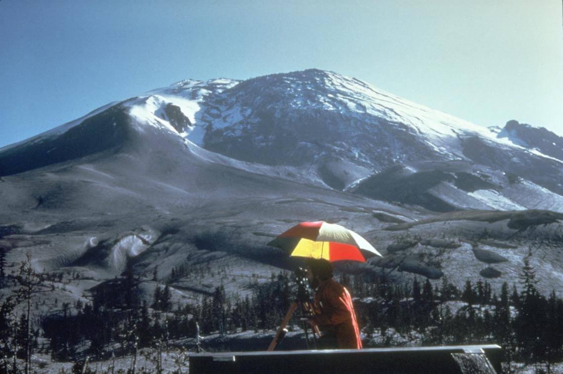
La protuberancia en el lado norte del Monte St. Helens se desarrolló a medida que el magma fue empujado hacia arriba dentro del pico antes del 18 de mayo de 1980. Vista desde el noreste.

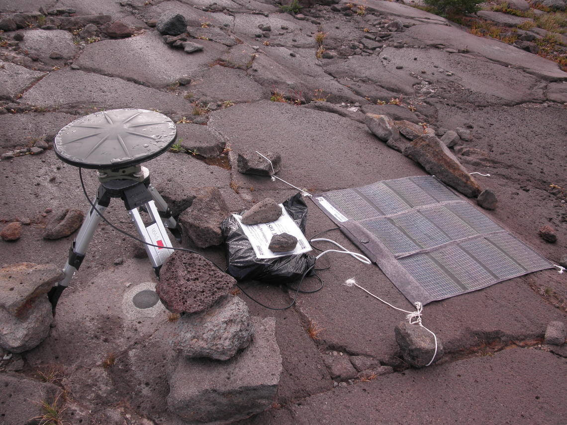
Estaciones GPS temporales recogen datos para analizar la deformación de la zona en Three Sisters, Oregón.
VOLCANO ACTIVE FOUNDATION RESPONSABILITY
nº 2195 authorised by the Madrid's Minister of Justice
NIF G67314625
SF Abocados Francesc Macia 7 pl17
08029 Barcelona, Spain
We may request cookies to be set on your device. We use cookies to let us know when you visit our websites, how you interact with us, to enrich your user experience, and to customize your relationship with our website.
Click on the different category headings to find out more. You can also change some of your preferences. Note that blocking some types of cookies may impact your experience on our websites and the services we are able to offer.
These cookies are strictly necessary to provide you with services available through our website and to use some of its features.
Because these cookies are strictly necessary to deliver the website, refusing them will have impact how our site functions. You always can block or delete cookies by changing your browser settings and force blocking all cookies on this website. But this will always prompt you to accept/refuse cookies when revisiting our site.
We fully respect if you want to refuse cookies but to avoid asking you again and again kindly allow us to store a cookie for that. You are free to opt out any time or opt in for other cookies to get a better experience. If you refuse cookies we will remove all set cookies in our domain.
We provide you with a list of stored cookies on your computer in our domain so you can check what we stored. Due to security reasons we are not able to show or modify cookies from other domains. You can check these in your browser security settings.
These cookies collect information that is used either in aggregate form to help us understand how our website is being used or how effective our marketing campaigns are, or to help us customize our website and application for you in order to enhance your experience.
If you do not want that we track your visit to our site you can disable tracking in your browser here:
We also use different external services like Google Webfonts, Google Maps, and external Video providers. Since these providers may collect personal data like your IP address we allow you to block them here. Please be aware that this might heavily reduce the functionality and appearance of our site. Changes will take effect once you reload the page.
Google Webfont Settings:
Google Map Settings:
Google reCaptcha Settings:
Vimeo and Youtube video embeds:
The following cookies are also needed - You can choose if you want to allow them:
You can read about our cookies and privacy settings in detail on our Privacy Policy Page.
PRIVACY POLICY