BUILDING RISK KNOWLEDGE
WHY THE FOUNDATION WAS BORN? >
WHY THE FOUNDATION WAS BORN? >
DISASTERS ARE NOT NATURAL, they are socially built, due to lack of preparation, prevention, mitigation work, education and monitoring. They are natural risks or hazards that impact vulnerable societies. Knowledge help reducing social and structural vulnerability in order to have more resilient societies!
Volcanic areas are very sensitive to erosion and dispersal of material which changes the landscape rapidly. This requires intensive monitoring to document the type and size of sediment, identify areas where sediment is eroded and deposited, and determine the rate and volume of sediment transport. These sediment data are integrated into computer models to design projects that reduce the impact of sediment accumulation.
Monitoring surveys are conducted in different ways:
Scientists make repeated field measurements over many years. These measurements are made with instruments that measure distance and angle to a reflector, or with GPS equipment using satellite positioning. Scientists compare the cross-sectional profiles obtained over time to assess erosion and deposition in the channel.
Digital Elevation Models (DEMs), which produce highly accurate maps of the land surface, can be created using digital photographs or lidar technology. These models created at different times can be compared to accurately define areas of erosion and deposition. The remotely collected data allows for detailed analysis of basin-wide changes and a deeper understanding of water and geological evolution.

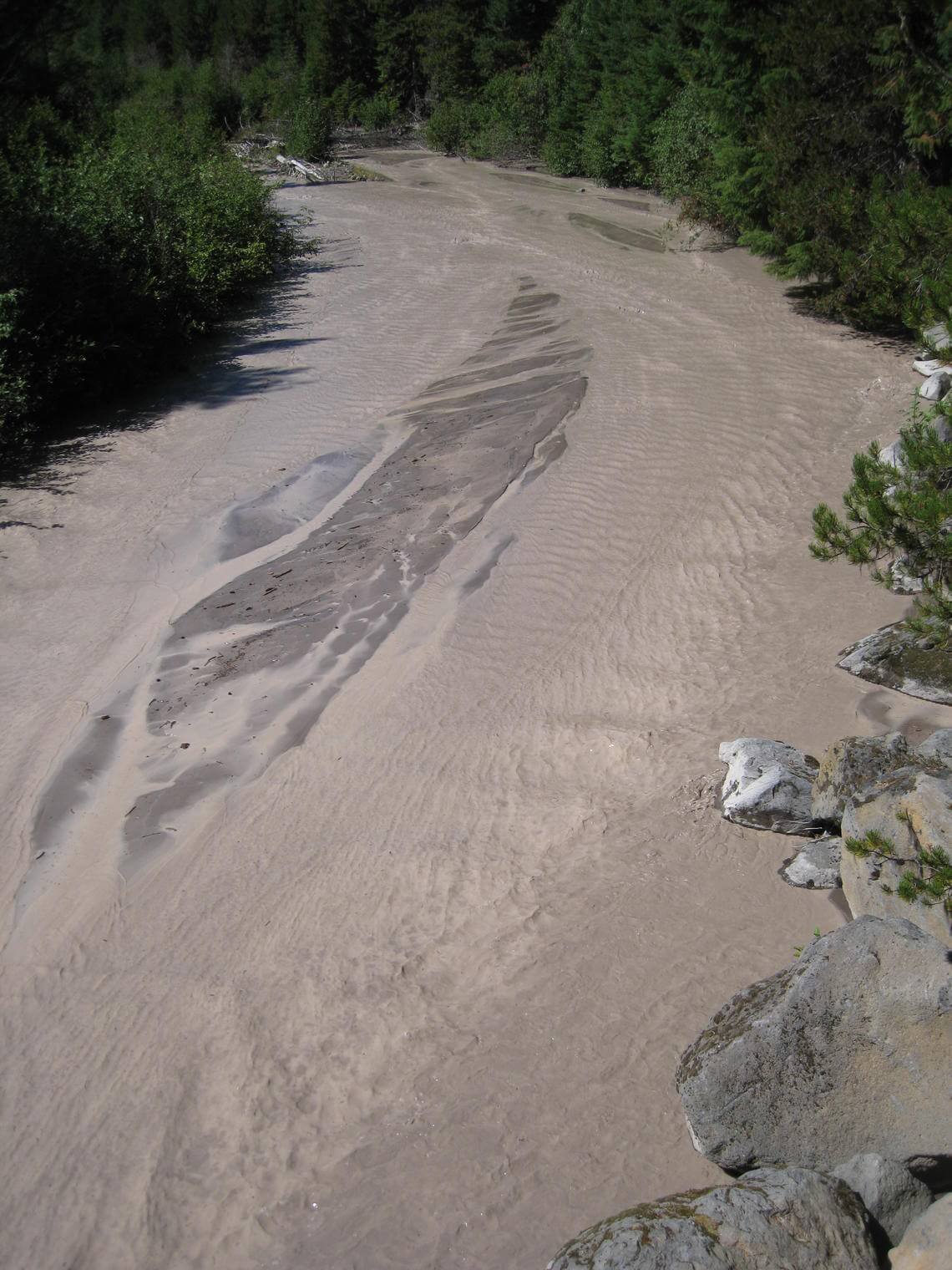
Sediment-laden White River 11 km downstream of the OR35 bridge. Heavy rains resulted in high-sediment loads within this river, which drains Mount Hood, Oregon.
Instruments installed at stations measure the water level, or stage, of rivers every 15 minutes, and self-pumping samplers frequently take water samples for laboratory analysis. By combining a continuous record of a river’s stage with frequent measurements of water flow and suspended sediment concentration, scientists calculate the total flow of water and suspended sediment to produce daily, monthly and annual totals. Technologies using light transmission (to measure turbidity), sound (hydroacoustic) and imagery (from satellites or digital cameras) allow for greater accuracy and efficiency in documenting sediment loads.

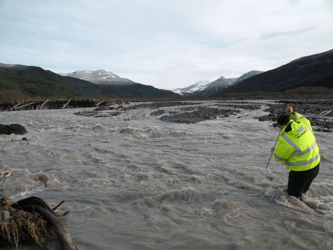
Suspended sediment sample collection from the North Fork Toutle River above the Sediment Retention Structure, downstream from Mount St. Helens.

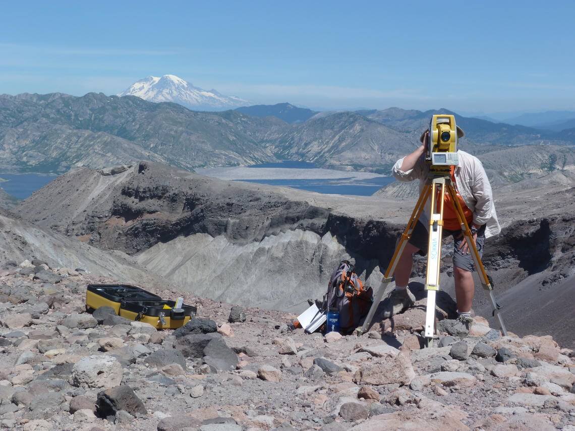
Annual surveys of water channels in the crater of Mount St. Helens track rates of erosion, aggradation.
VOLCANO ACTIVE FOUNDATION RESPONSABILITY
nº 2195 authorised by the Madrid's Minister of Justice
NIF G67314625
SF Abocados Francesc Macia 7 pl17
08029 Barcelona, Spain
We may request cookies to be set on your device. We use cookies to let us know when you visit our websites, how you interact with us, to enrich your user experience, and to customize your relationship with our website.
Click on the different category headings to find out more. You can also change some of your preferences. Note that blocking some types of cookies may impact your experience on our websites and the services we are able to offer.
These cookies are strictly necessary to provide you with services available through our website and to use some of its features.
Because these cookies are strictly necessary to deliver the website, refusing them will have impact how our site functions. You always can block or delete cookies by changing your browser settings and force blocking all cookies on this website. But this will always prompt you to accept/refuse cookies when revisiting our site.
We fully respect if you want to refuse cookies but to avoid asking you again and again kindly allow us to store a cookie for that. You are free to opt out any time or opt in for other cookies to get a better experience. If you refuse cookies we will remove all set cookies in our domain.
We provide you with a list of stored cookies on your computer in our domain so you can check what we stored. Due to security reasons we are not able to show or modify cookies from other domains. You can check these in your browser security settings.
These cookies collect information that is used either in aggregate form to help us understand how our website is being used or how effective our marketing campaigns are, or to help us customize our website and application for you in order to enhance your experience.
If you do not want that we track your visit to our site you can disable tracking in your browser here:
We also use different external services like Google Webfonts, Google Maps, and external Video providers. Since these providers may collect personal data like your IP address we allow you to block them here. Please be aware that this might heavily reduce the functionality and appearance of our site. Changes will take effect once you reload the page.
Google Webfont Settings:
Google Map Settings:
Google reCaptcha Settings:
Vimeo and Youtube video embeds:
The following cookies are also needed - You can choose if you want to allow them:
You can read about our cookies and privacy settings in detail on our Privacy Policy Page.
PRIVACY POLICY